Wednesday, 10 September 2014

Bryce Canyon National Park, Utah

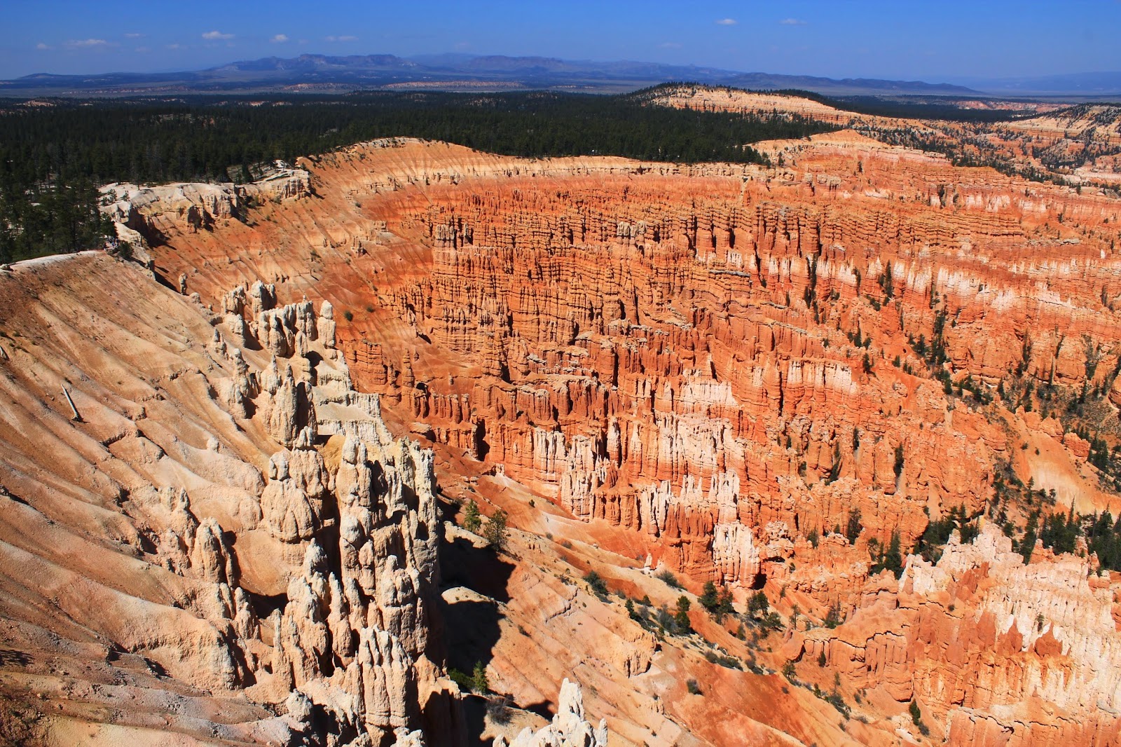
On this trip, I find I'm ending up with a larger number of interesting photos than previously. So there will be a few blog entries which dispense with the usual waffle and instead consist mostly of visual delights. Starting with this one, from Bryce Canyon.

Bryce Canyon amphitheatre

from Paria View

from Paria View again

from Sunrise Point

from Yovimpa Point

from Farview Point

A chipmunk at the Black Dragon Canyon scenic overlook, on Interstate 70 westbound.
I have named him Timmy.

Monday, 8 September 2014

Moab, Utah

My last act in Colorado, before leaving for Utah, was to visit Black Canyon of the Gunnison National Park. This canyon is narrow but spectacularly deep (1,800ft). The visitor centre is at the top and there are no formal roads or paths to the canyon floor: all the recognised trails just skirt the rims above the canyon. If you want to dip your toes in the Gunnison river at the bottom, then you have to get there at your own risk. At the bottom of the canyon there is no staffing, no mobile phone reception, and no access for rescue helicopters...

Pah. Arriving at the visitor centre, I pushed my way through a crowd full of beer guts, triple chins, bingo wings and elasticated-waist jeans - all of them there only for the view from the top - and after a brief negotiation with a friendly National Park Service ranger, I was handed my Wilderness Permit. Man-card renewed.

The descent was tough but straightforward, a rocky downhill scramble mostly in a straight line. There's one particularly dodgy 80-foot stretch, but it has a long metal chain tied to a tree at the upper end so that you can hand yourself down a bit more safely. Anyway I got to the bottom after a couple of hours, and duly dipped my toes in the river. There was nobody else around at all. Just the sun shining, and the river burbling along, and the vast canyon walls teetering overhead.

Had this been at sea level, I dare say the way back up wouldn't have been too bad. But the canyon floor sits 5,440ft above sea level and there is a resulting deficiency of oxygen, which has always been one of the elements I cherish most fondly. I was thoroughly knackered by the time I regained the cliff tops.

During one of my little breathers mid-slope, I suddenly realised that I was sitting right next to a fairly big yellow and black snake, about the width and length of a decent-sized climbing pole. It seemed entirely unperturbed by my presence. I can't say I reciprocated the sentiment, but as I was situated halfway up a very rocky cliffside, running was not an option in any direction. Thankfully the snake wasn't a rattler.

(I have to confess that the Gunnison photos below aren't mine. For reasons I won't bore you with, none of the photos I took there survived the day. Google Images has had to step in.)

On Sunday I visited two more National Parks, Canyonlands and Arches, for which see photos below - and these photos are my own. (Spooky coincidence - during this drive my MP3 player, on shuffle setting, threw up a song called 'Another Park, Another Sunday'. It's by the Doobie Brothers). There were no big hikes in these two parks, just scenic drives and short trails, but the photos will hopefully tell the whole story.

Moab itself is small but very nice. It mainly serves as a tourist hub for the surrounding parks. Even by American standards, there's a strong individualistic and libertarian ethos around here: you can buy T-shirts that say 'Sure, you can trust the government - just ask an Indian'.

The Moab Brewery is impressive and the standouts for me were Red Rye and Derailleur. I was also amused to be served an 'English style mild amber ale' which was both cold and fizzy. Bless 'em. It was pretty good though.

Black Canyon of the Gunnison, from the Pulpit Rock overlook (not my photo - see above)

Black Canyon from the Gunnison river at the bottom (again not my photo - see above)


Above is a short video from Arches National Park, complete with atmospheric soundtrack.

Arches National Park. This is Landscape Arch.

Landscape Arch partially collapsed in 1991 and somebody managed to get it on camera.
Not my photo again, obvs.


Arches National Park


Arches National Park: this is called Balanced Rock.

Arches National Park. Another rock which doesn't look entirely stable. In a canyon called Park Avenue (see below).

Arches National Park: Park Avenue Canyon


Canyonlands National Park

Canyonlands National Park

Canyonlands National Park

Canyonlands National Park

Canyonlands National Park

Thursday, 4 September 2014

Grand Junction, Colorado

Metro to Newcastle Airport, short flight to Paris, long flight to Atlanta, short flight to Denver. Picked up the hire car, and here I am!

(My example to all aspiring travel bloggers...don't sweat the small stuff.)

Right now I'm in Grand Junction and it's pretty nice. It's big enough to have all the amenities, but it's also sufficiently small that you can hear the cicadas chirping on Main Street. The all-American suburbs - quiet tree-canopied streets with wide sidewalks, raised timber houses, ancient rusting Dodges and Lincolns parked between the pick-up trucks - are only a couple of blocks away. Main Street itself contains only independent locally-owned stores, with not a big-chain logo in sight. You can still go to Starbucks or Walmart if you really want to; you just have to head a little way out of town. It's an example which many other cities would do well to follow.

Random fact: in this valley the roads were originally named according to how many miles they were from the state line between Colorado and Utah. The roads were meant to be laid at whole-mile intervals from the border. But there were some fields and orchards which nobody wanted to spoil. The inevitable result was expressed variously in fractions and decimals, leaving us with (for example) 27 3/4 Road and 11.5 Road. I'm not kidding.

After leaving Denver I initially drove south to Alamosa and spent a night there. Walking between motel and bar, I crossed a deserted bridge over a modest little river, about 20 metres across. I did a double take when I saw the sign: 'Rio Grande'. It rises in Colorado. The last time I saw that river was in Texas last year, where it's rather bigger and serves as part of the border between Mexico and the USA.

The drives south to Alamosa and then north to Grand Junction were both very long but full of stunning scenery. See photos below. I was greatly entertained by some of the road signs along the way, such as 'Correctional Facility: Do Not Stop For Hitch Hikers' (um...okay) and 'Speed Checked By Aircraft' (really? really?!) Other than me driving and enjoying the view, not a whole lot has happened so far. I've had one short hike, in Great Sand Dunes National Park. I say 'short', but climbing a 750-foot sand dune at 90 degrees F is not exactly easy going, especially when you start at 8,000 feet above sea level and there isn't too much oxygen to be had. The descent was great fun, though: the slippy softness of the sand, so frustrating on the way up, means you can just run and indeed bounce all the way down; there's almost no strain on the knees, no risk of turning an ankle. It feels like walking on the moon.

Obviously I've been trying out the local beers and some of them have stood out. Here in Grand Junction the Rockslide brewery have done well with Cold Shivers Pale Ale and Raspberry Wheat. The latter could well be that very rare thing, a unisex beer. In Alamosa, the San Luis Valley brewery served up Hefe Suave (unfiltered, weirdly clear in the glass, but nice) and Alamosa Amber (pleasing malty taste to offset the hops).

Incidentally, all my beers so far have been bought with the dollars so kindly presented to me by my former colleagues at the CQC. Thanks guys. Love you all. Now get back to work.


Great Sand Dunes National Park, from the top of the tallest dune.


Mountains and sand.

Mostly sand.

Blanca Peak (14,345ft), seen from highway 160.
Eagle-eyed readers will note that I couldn't be arsed to get out of the car before taking the photo.

The Rio Grande, somewhere on highway 149. 

Edd vs Food #12
Spicy chicken burrito, from the Cascada Bar & Grill in Creede (pop: 403, elev: 8,799ft)
Nothing spectacular to look at. Hey, I'm just getting warmed up.

Weminuche wilderness.
The peak in the far distance is about 30 miles away.

Another view from Highway 149...

...and another.